Posts

Showing posts from June, 2022

Why Are My Weather Posts Missing From Facebook.

Hello everyone. I just wanted to let you know that my Facebook page was shut down without any warning by Facebook this past Saturday, June 8th. All I was told was that I had violated their community standards. I don't know what triggered that; they didn't tell me. I was told this may be permanent or for six months.
My guess is that it may be because I posted several comments and articles from my Substack page about the riots in LA, and that must have triggered/angered someone, and they complained, thus Facebook shut me down. I don't know this as fact, though. I have appealed this decision, and I'm still waiting for their reply. I have read on X that this has happened to other Facebook users posting about the LA riots as well.
I always share my weather blog posts (that I post here) on my Facebook page and my X page. This included over twelve different New Mexico and West Texas Facebook Community sites. So there are thousands of you out there (based on my views and shares of those posts) who will no longer see those posts. My Facebook page may or may not be restored.
This is another good reason (as the National Weather Service often reminds us) to have multiple ways of receiving severe weather alerts when severe weather threatens your location. My weather web page is one of those ways, and I really appreciate all of you who have and still do use it. Thank you so much!!!
If my Facebook page is restored, I will continue to share my weather blog posts and some of the NWS Watches and Warnings...as I have been doing for years now.

New Daily Record High Temperatures - June 2022.

Image
New Daily Record High Temperatures. (June 2022). With the widespread moderate to heavy rainfall and cooler temperatures over the state over the past couple of weeks, it has been easy to forget how hot the first half of the month was. A total of 111 new daily record high temperatures were set. Leading the pack was the Tucumcari Aiport which set a new all-time June record high temp as well as a new all-time high temp for them of 112º set on the 11th. Their previous all-time record high was 110º set on July 13, 2020. The Carlsbad and Roswell Airports both set new daily record highs of 111º on the 11th and 12th. The Artesia Climate Co-Op Station set a new daily record of 110º on the 13th.  There Are None So Blind As Those Who "Will - Not" To See...107.

The Rains Came - So Did The Flooding.

Image
Carlsbad, New Mexico's Wet Microburst.   NWS Midland Dual Pol Doppler Radar Snapshot. (3:11 PM MDT Sunday, June 26, 2022). A  thunderstorm quickly became severe as it rolled into the east side of Carlsbad around 3:15 PM MDT Sunday afternoon. A Personal Weather Station (PWS) Ridgecrest Subdivision  located on the east side of Carlsbad clocked a peak wind gust of 75 mph during the wet microburst it produced. That station also measured 1.60" of rainfall in less than an hour and the 24-hour total came to 2.28". Chaves & Eddy County Heavy Rainfall Totals. ROSWELL, N.M.  (KRQE) – Severe flooding over the weekend in southeast New Mexico has caused multiple homes in Roswell to be lost. Roswell Community Disaster Relief Services say three homes have flooded on the north side of town, leaving those families displaced. Courtesy Of The City Of Roswell Facebook Page. Sunday (June 26) flooding impacts: Bridge on East Mescalero Road at La Jara Road over Berrendo River (wh...

6-22-2022 Rainfall Summary - Weekly Totals & Month-To-Date Totals.

Image
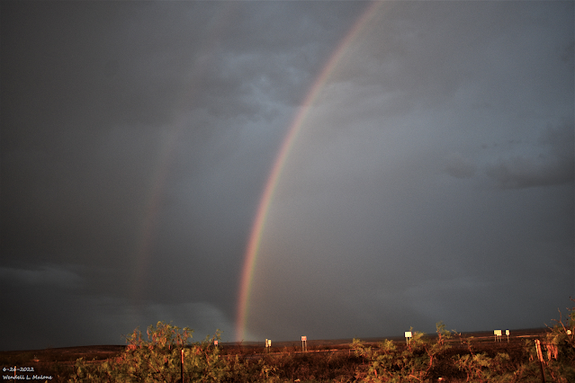
June 19, 2022. West Of Brantley Lake. Looking West On St Hwy 137. CoCoRaHS 7-Day Rainfall Totals. (June 16 - 22, 2022). CoCoRaHS June 2022 Rainfall Totals. (June 1 - 22, 2022). Weather Underground 7-Day Rainfall Totals. (June 16 - 22, 2022). New Mexico Mesowest Rainfall Totals. 7-Day & 30-Day Totals). New Mexico Rainfall Totals. 5-Day Totals. (As Of 6 AM MDT Wednesday, June 22, 2022) 7-Day Totals. (As Of 6 AM MDT Wednesday, June 22, 2022) 30-Day Totals. (As Of 6 AM MDT Wednesday, June 22, 2022) Selected 7-Day & Month-To-Date Rainfall Totals. (As Of 9 AM MDT Wednesday, June 22, 2022). Wimsatt PWS - Roachshack 3.52"  8.16" Cox Canyon PWS - Ponderosa Pines 2.86" 7.71" Wimsatt PWS - Wimsatt Cabin 2.62"  7.29" Bell Canyon PWS 4.35"  5.30" Capitan 4.3 WSW 4.68"   5.08" Cloudcroft PWS - Dalton's Mountain 1.99"  4.38" Cloudcroft 4.0 E 4.00"   4.21" Nogal 4.6 SSE 3.35"  3.96" Alto PWS 3.38"  ...

NWS Albuquerque Burn Scar Matrix

Current National Weather Service Watches/Warnings In Effect.

New Mexico

Chaves County Plains & Mtn's

Eddy County

Culberson County

Lea County

Lincoln County

Otero County

Current US Temps

Current US Wind Chill/Heat Index Temperatures

WPC 7-Day Precipitation Forecast

Roswell Live EarthCam

Ruidoso Live Webcam

Cloudcroft Live Webcam

NWS Midland 3-Day Precipitation Forecast

NWS Midland 3-Precipitation Chances

New Mexico 3-Day Precipitation Forecast

New Mexico Precipitation Chances

NWS El Paso 3-Day Precipitation Forecast

NWS El Paso Precipitation Chances

US 24-Hour Precipitation Forecast

US 3-Day Precipitation Forecast