Posts

Showing posts from January, 2022

Current Date & Time

Fall Freeze Data For New Mexico

Major Long-Duration Winter Storm To Impact New Mexico & Nearby Areas!
Image
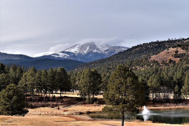
Sierra Blanca Peak. Sunday, January 30, 2022. Major Long Duration Winter Storm To Impact New Mexico & Nearby Areas! Canadian (GEM) 500 Mb (18,000') Forecast. Valid At 5 PM MST Wednesday. As has been the case for the past couple of days the computer forecast models are still struggling in trying to resolve the track, speed, and location of the 500 millibar winter storm set to impact a large swath of the region Tuesday into Saturday. Several models like the Candian above continue to hint at a closed low forming over the area Wednesday into Thursday. This would prolong the snowfall with more widespread heavier amounts. But overall there remain a lot of differences yet to be resolved which will have an impact on our local forecasts...possibly significant. So be prepared to see changes in our local forecasts. Surface Map Forecast. Valid At 5 AM MST Wednesday. A bitterly cold Siberian airmass is slated to slide into most of New Mexico beginning Tuesday across the northeastern plains ...
First Look At Next Weeks Cold & Winter Storm.

Image
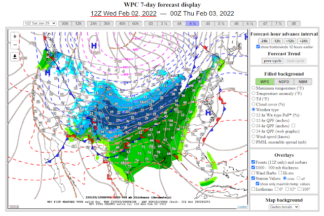
Surface Map Forecast . Valid Next Wednesday. GEM 500 Millibar (18,000') Forecast. Valid At 5 PM MST Wednesday, February 2, 2022.   Computer Model Storm Total Snowfall Forecasts. (Next Wednesday Through Friday). Canadian Model (GEM). U.S. Model (GFS). European Model (ECMWF). German Model (ICON). National Blend Of Models (NBM). Canadian Model (GEM) Temperature Forecasts. (At 5 AM MST Saturday, February 5, 2022). U.S. Model (GFS) Wind Chill Forecast. (Thursday Morning At 5 AM MST). Canadian Model (GEM) 10-Day Temperature Forecasts. Albuquerque. Santa Fe. Clovis. Roswell. Carlsbad. Sierra Blanca Regional Airport. Local National Weather Service Office Outlooks. Coldest/Strongest Winter Storm This Season Next Week? Computer forecast models this morning were relatively close to one another considering their forecasts for a winter storm to impact the state and region next week. As always the models have their differences in the strength, timing, and track of the storm but all agree that wi...
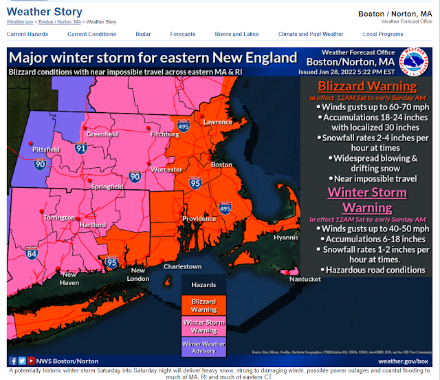
Historic Major Winter Storm For Southern New England Tonight Into Saturday!

Image
A fascinating Area Forecast Discussion (AFD) from the Norton/Boston, MA National Weather Service Forecast Office this afternoon. You just don't see this very often. I want so bad to be there. Blizzard Warnings! Quote- "FXUS61 KBOX 282125 AFDBOX Area Forecast Discussion National Weather Service Boston/Norton MA 425 PM EST Fri Jan 28 2022 .SYNOPSIS... A cold front moves through the region this afternoon, possibly accompanied by a few snow showers or flurries. A historic major winter storm will impact much of southern New England Saturday into Saturday evening, bringing heavy snow, blizzard conditions to the much of southeastern New England, and possibly damaging winds and coastal flooding. Drier weather returns with below normal temperatures Sunday before a warm up next week. && .NEAR TERM /UNTIL MIDNIGHT TONIGHT/... Quiet before the storm through this evening. So be sure to take advantage to make any pre-storm preparation. There are some flurries or scattered light sn...

First Ice Storm Of The Season Late Tonight Into Wednesday.

Image
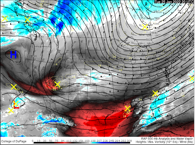
Next Round Of Winter Weather Tonight Into Wednesday. RAP 500 MB Analysis. Valid At 1 PM MST Tuesday. ECMWF 500 MB Forecast. Valid At 11 AM MST Wednesday. Looking at the 18,000' level (500 Millibars) of the atmosphere this Tuesday afternoon shows that a fairly strong and cold mid-upper level storm was centered over far northwestern Arizona as of 1 PM MST. This next inbound winter storm is forecast to continue moving southeast tonight into Wednesday morning. By around noontime tomorrow it is forecast to be located near Ruidoso. The storm is then forecast to swing east out of the state into the Texas Panhandle by sunset. Surface Map & Precipitation Type Forecast. Valid Tonight. Valid Wednesday. Current Temperatures At 3 PM MST. Current Wind Chill Temperatures At 3 PM MST. Temperatures Drop Tonight & Won't Recover Wednesday! Arctic air has entered far northeastern New Mexico as of 3 PM MST this Tuesday afternoon. Temperatures at Raton and Clayton were near freezing with win...

My Blog Archive List (July 2010 - August 2025).

Show more

My Current Weather Conditions

MY CoCoRaHS Precipitation Data

NWS Albuquerque 2026 Winter Outlook

Eddy County

Guadalupe Mtns Eddy & Culberson County

Lea County

NWS Midland Web Page

NWS Midland Web Page
Click On The Map To Open It Up

SE New Mexico & West Texas Precipitation Forecasts

NWS Midland Hazardous Weather Outlook

NWS Midland Hazardous Weather Outlook
Click On The Image To See The Rest Of The Outlooks

NWS Midland Hazardous Weather Outlook

NWS Midland Hazardous Weather Outlook

NWS Midland Forecast Graphic

NWS Midland Graphic Forecast

NWS Midland Forecast High Temperatures Today

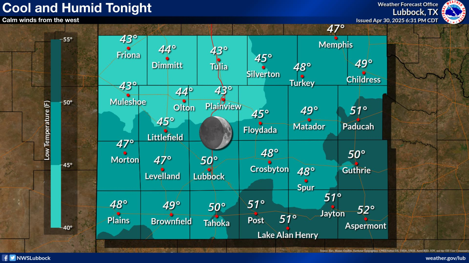
NWS Midland Forecast Low Temperatures Tonight

New Mexico

Chaves County Plains & Mtn's

Lincoln County

NWS Albuquerque Web Page

NWS Albuquerque Web Page
Click On The Map To Open It Up

NWS Albuquerque New Mexico Precipitation Forecasts

NWS Albuquerque Hazardous Weather Outlook

NWS Albuquerque Hazardous Weather Outlook

NWS Albuquerque Graphic Forecast

NWS Albuquerque Forecast Grpahics

NWS Albuquerque Forecast Graphics

NWS Albuquerque Forecast Graphic

NWS Albuquerque Forecast High Temperatures Today

NWS Albuquerque Forecast Low Temperatures Tonight

NWS Albuquerque Wind Chill Forecast

NWS Albuquerque Peak Wind Gust Forecast

Texas

Otero County

NWS El Paso Web Page

Southern New Mexico & Far West Texas Precipitation Forecasts

NWS El Paso Hazardous Weather Outlook

NWS El Paso Hazardous Weather Outlook
Click On The Image To See The Rest Of The Outlooks

NWS El Paso Hazardous Weather Outlook

NWS El Paso Hazardous Weather Outlook
Click On The Image To See The Rest Of The Outlooks

NWS El Paso Graphic Forecast

NWS El Paso Graphic Forecast

NWS El Paso Graphic Forecast

NWS El Paso Forecast High Temperatures Today

NWS El Paso Forecast Low Temperatures Tonight

NWS El Paso Wind Chill Forecast

NWS Lubbock Web Page

NWS Lubbock Web Page
Click On The Map To Open It Up

NWS Lubbock South Plains Precipitation Forecasts

NWS Lubbock Hazardous Weather Outlook

NWS Lubbock Hazardous Weather Outlook
Click On The Image To See The Rest Of The Outlooks

NWS Lubbock Graphic Forecast

NWS Lubbock Graphic Forecast

NWS Lubbock Hi Temperature Forecast Today

NWS Lubbock Low Temperature Forecast Tomight

My Rainfall Totals - 2.1 NNW Downtown Carlsbad

My Rainfall Totals - 2.1 NNW Downtown Carlsbad

My Seasonal Snowfall Totals - 2.1 NNW Downtown Carlsbad

My Seasonal Snowfall Totals - 2.1 NNW Downtown Carlsbad

Disclaimer

This blog and its contents are for informational purposes only! Always have multiple sources of information available to rely upon during severe weather. Do not rely solely on the Internet. Be weather-aware, plan ahead, have a backup plan, and be ready to act before severe weather strikes your location.