

Winter Off To An Early Start - Next Arctic Outbreak Late Next Week.
Over 2,000 Cold & Snow Records Set
This Past Week Across The USA.

"Redfield, NY picked up 44" of snow."

2013 CONUS Lower-48 December mon-to-date temperature
virtual tie w/2005 & 2009 for coldest start to month since 1979.
Heavy Snow Buries Jerusalem.


Snow On The Sphinx - First Snowfall In Cairo, Egypt In At Least 112 Yrs.
Jerusalem has been hit with several heavy snow storms which have in effect shut the city down. Tens of thousands are reported to be without power, and thousands of people were stranded on Highway 1 and Road 443 Thursday night into Friday morning. I saw a report yesterday (Friday) that Jerusalem had already received 19" of snow with more forecast to fall. Snow also fell as far south as Cairo, Egypt...reportedly the first time in the past 112 years.
Next Arctic/Polar Outbreak Late Next Week.


00Z/ 5 PM MST GFS 500 MB Forecast.
Valid @ 5 PM MST Friday, December 20, 2013.

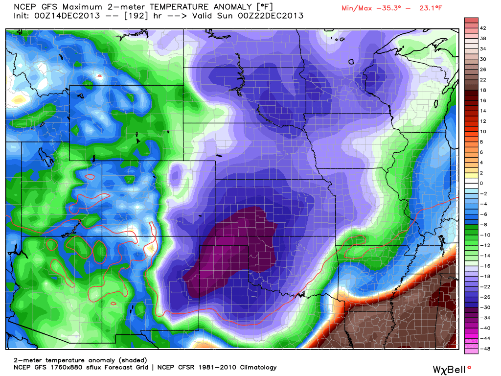
00Z/5 PM MST GFS Temperature Anomaly Forecast.
Valid @ 11 AM MST Saturday, December 21, 2013.
00Z/5 PM MST GFS Temperature Anomaly Forecast.
Valid @ 5 PM MST Saturday, December 21, 2013.

00Z/5 PM MST GFS Temperature Forecast.
Valid @ 5 PM MST Saturday, December 21,2013.

00Z/5 PM MST GFS Wind Chill Temperature Forecast.
Valid @ 5 PM MST Saturday, December 21,2013.


For nearly a week now the weather community has been ablaze with talk/speculation about next weeks potential arctic/polar outbreak. Once again I chose not to get too specif with the individual computer forecasts since they've already started flip flopping around on their forecasts concerning this event. I seriously doubt that we will have a good handle on this until late next week.
Typically the models have a hard time forecasting arctic/polar outbreaks. Given that we are still roughly a week away from the event complicates the forecasts since the models also do not do all that well this far out. But the trends continue to point to another brutally cold outbreak of a very cold airmass with its origins possibly originating in Siberia.
Also of concern is the models latest runs indicating the potential for some of the upper-level energy closing off, possibly forming a closed or cutoff 500 millibar low, over or near the Desert Southwest next weekend. Whether or not this happens is till uncertain but needs to be watched.
Just how cold this next blast of arctic/polar air will be is also unknown at this time. There is the possibility that we could be looking at another multi-day event of subfreezing temperatures beginning as early as late this week, and continuing into the weekend. Some of the models have hinted that we could be looking at temperatures as cold as the single digits and teens with wind chill values below zero by next Sunday morning.
The Truth Is Stranger Than Fiction!
My Web Page Is Best Viewed With Google Chrome.


Comments
Post a Comment
Your comments, questions, and feedback on this post/web page are welcome.