Posts

Showing posts from August, 2020

Current Date & Time

Countdown To Fall Weather Underway.

Image
What A Crazy Year This Has Been So Far. U.S. GFS 500 MB (18,000' MSL) Forecast. Valid At Noon MDT Tuesday, September 1, 2020. U.S. GFS 500 MB (18,000' MSL) Wind Forecast. Valid At Noon MDT Tuesday, September 1, 2020. Changes Blowin In The Wind. That heading is literal as the Jet Stream is starting to get active once again. Computer models forecast a mid and upper-level trough of low pressure to dive southeastward out of the Pacific Northwest and into the Four Corners area by Tuesday. The GFS wants to open up a closed low and move it across the state. The European and Canadian models drop it further back to the west into Arizona and stall it. Either way, our chances for cooler and wetter weather are going to increase the first to middle of the upcoming work week.  As we head into the meteorological fall (begins Tuesday) the Jet Stream will increasingly become more active and dig further and further to the south. Eventually displacing the summer heat ridge that has baked us all s...

First Look At Winter - Grand Solar Minimum Still Coming.

Image
Courtesy of Famers Almanac. First Look At Winter.       As I write this it is 105ºF in Carlsbad, New Mexico . This marks the 60th time this summer I've hit 100ºF or higher here at our home on my Davis Vantage Pro+ Wireless Home Weather Station. Even though we live in the arid high desert Southwest, enough already. This is the year it seems summer is never going to end.      So how about something different, something to distract you from the heat and drought? Farmers Almanac  has released it's 2020-2021 Winter Forecast.       Long-range forecasting has never been my cup of tea but I've always admired those who attempt this almost impossible feat. Given how hot and dry our summer has been don't be surprised if Mother Nature tries to swing the pendulum the other way (cold winter) to balance herself out. Remember: "What goes up - always comes down, it's just of when."      " “Based on our time-tested weather formula, the...

Hurricane Laura Update - Tuesday, August 25, 2020.

Image
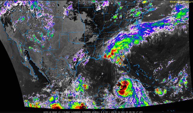
Hurricane Laura Satellite Images. 3:51 PM MDT Tuesday, August 25, 2020 - True Color Visible. 3:46 PM MDT Tuesday, August 25, 2020 - Visible/IR Combined (Sandwich). 3:57 PM MDT Tuesday, August 25, 2020 - Clean (LWIR). Forecast Tracks Of Hurricane Laura. National Hurricane Center. National Weather Service Houston/Galveston. National Weather Service Lake Charles. Computer Model Forecast Tracks Of Hurricane Laura. ECMWF EPS Ensemble Mean. Maximum Wave Height Forecast.       Incredible wave heights are forecast to peak around Wednesday afternoon offshore southeast of Houston, Texas. How about 75 feet according to the ECMWF model. Weather Prediction Center 7-Day Rainfall Forecast. Hurricane Laura To Become A Major Hurricane Before Landfall.      As of 4:30 PM MDT this afternoon Hurricane Laura continues to churn west-northwestward at 17 mph across the open Gulf of Mexico headed for a Texas landfall. The latest forecasts from the National Hurricane Center call for...

Tropical Storm Laura - Monday, August 24, 2020.

Image
Tropical Storm Laura. 2:56 PM MDT Monday, August 24, 2020. Tropical Storm Laura. 3:01 PM MDT Monday, August 24, 2020. Tropical Storm Laura. 2:57 PM MDT Monday, August 24, 2020. National Hurricane Center Track Forecast. European Forecast Model Ensemble Mean Track Forecast. Tropical Storm Laura To Strengthen Tonight. Weather Prediction Center Storm Total Rainfall Amounts. (Tonight Into Next Monday).       Tropical Storm Laura was located near 21.7N and 82.2W or 40 miles east of the Ise of Youth as of 3 PM MDT or 4 PM CDT this Monday afternoon. She has sustained winds of 60 mph with gusts near 70 mph. Her central pressure remains fairly steady at 1001 millibars or 29.56 inches of mercury. Laura is moving steadily to the west-northwest at 20 mph.       Tropical Storm Laura is forecast to begin steadily strengthening tonight as she pulls away from Cuba and enters the southeastern Gulf of Mexico. Rapid intensification is forecast by the Hurricane computer forec...

Hurricane Marco - Tropical Laura & New Mexico Smoke.

Image
Western U.S. GOES-16 GeoColor (CIRA) Satellite Image. (At 9:10 AM MDT Sunday, August 23, 2020). NWS Lubbock @NWSLubbock Level 1: In today's GOES-16 image, you can see the enhanced fire detection ability of the satellite. Check out the bright ares in the yellow circles. They depict heat from active wildfires. We use this a lot during our spring wildfire season here in West TX too #lubwx #scienceiscool BoulderCAST Weather @BoulderCAST · Aug 21 There's a lot of smoke floating around the stalled ridge of high pressure in the western United States. Also neat to see all the smoke being pulled in to the remnants of once Category 4 #HurricaneGenevieve near the Baja... #COwx #Smoke #HRRRSmoke #CAwx Western U.S. Fires.       August 23, 2020 Currently, 93 large fires have burned more than 1.6 million acres in 13 states. More than 26,000 wildland firefighters and support personnel are assigned to incidents across the country. Evacuation orders are in effect for residents near...

My Blog Archive List (July 2010 - August 2025).

Show more

My Current Weather Conditions

MY CoCoRaHS Precipitation Data

NWS Albuquerque 2026 Winter Outlook (Updated Nov 3rd).

NWS Midland Web Page

NWS Midland Web Page
Click On The Map To Open It Up

SE New Mexico & West Texas Precipitation Forecasts

Eddy County

Guadalupe Mtns Eddy & Culberson County

Lea County

NWS Midland Hazardous Weather Outlook

NWS Midland Hazardous Weather Outlook
Click On The Image To See The Rest Of The Outlooks

NWS Midland Forecast High Temperatures Today

NWS Midland Forecast Low Temperatures Tonight

NWS Midland Peak Wind Gust Forecast

NWS Midland Graphic Forecast

NWS Midland Graphic Forecast
Areas of dense fog will impact southeast New Mexico, the northwestern Permian Basin, portions of the Guadalupe, Delaware, and Davis Mountains, the Upper Trans Pecos, Van Horn and I-10 Corridor, and parts of the Big Bend through Thursday morning. Visibility will be reduced to 1/4 mile or less at times. Use extra caution if driving in fog this morning.

NWS Midland Forecast Graphic

NWS Midland Forecast Graphic
A damage survey concluded a thunderstorm produced two tornadoes in Gaines and Dawson counties, respectively, on the evening of November 14th. Here are the findings and details of the survey.

NWS Albuquerque Web Page

NWS Albuquerque Web Page
Click On The Map To Open It Up

NWS Albuquerque New Mexico Precipitation Forecasts

New Mexico

Chaves County Plains & Mtn's

Lincoln County

NWS Albuquerque Hazardous Weather Outlook

NWS Albuquerque Hazardous Weather Outlook

NWS Albuquerque Forecast High Temperatures Today

NWS Albuquerque Forecast High Temperatures Today

Today's High Temperature Difference From Climatology

Today's High Temperature Difference From Climatology

NWS Albuquerque Forecast Low Temperatures Tonight

NWS Albuquerque Forecast Low Temperatures Tonight

Tonight's Low Temperature Difference From Climatology

Tonight's Low Temperature Difference From Climatology

NWS Albuquerque Wind Chill Forecast

NWS Albuquerque Peak Wind Gust Forecast

NWS Albuquerque Graphic Forecast

NWS Albuquerque Graphic Forecast
A Dense Fog Advisory is in effect through 9AM MST for southeast NM, including Roswell.

NWS Albuquerque Graphic Forecast

NWS Albuquerque Graphic Forecast
Dense Fog is likely to return to areas of east-central and southeastern New Mexico tonight into Thursday morning. Low visibility as low as a quarter mile will impact the morning commute in these areas.

NWS Albuquerque Graphic Forecast

NWS Albuquerque Graphic Forecast
Gusty winds return Friday across the forecast area. The strongest winds gusting to 35 to 45 mph will focus through northeastern New Mexico. Light objects may blow about while crosswinds will create difficult travel on area highways for high profile vehicles.

NWS Albuquerque Forecast Grpahics

NWS Albuquerque Forecast Grpahics
Above normal temperatures through Friday drop below average this weekend and remain near to slightly below average through next week.

NWS El Paso Web Page

Southern New Mexico & Far West Texas Precipitation Forecasts

Texas

Otero County

NWS El Paso Hazardous Weather Outlook

NWS El Paso Hazardous Weather Outlook
Click On The Image To See The Rest Of The Outlooks

NWS El Paso Forecast High Temperatures Today

NWS El Paso Forecast Low Temperatures Tonight

NWS El Paso Wind Chill Forecast

NWS El Paso Peak Wind Gust Forecast

NWS El Paso Graphic Forecast

NWS El Paso Graphic Forecast

NWS El Paso Graphic Forecast
Wind Gusts for November 20-21

NWS El Paso Graphic Forecast

NWS Lubbock Web Page

NWS Lubbock Web Page
Click On The Map To Open It Up

NWS Lubbock South Plains Precipitation Forecasts

NWS Lubbock Hazardous Weather Outlook

NWS Lubbock Hi Temperature Forecast Today

NWS Lubbock Low Temperature Forecast Tomight

NWS Lubbock Graphic Forecast

NWS Lubbock Graphic Forecast
A Dense Fog Advisory is in effect until 10 am Thursday for the South Plains, far southern Texas Panhandle, and much of the Rolling Plains.

NWS Lubbock Graphic Forecast

NWS Lubbock Graphic Forecast
Fog, dense at times, will continue through late morning. Skies will gradually clear out this afternoon with highs in the upper 50s to upper 60s. Overnight lows will be in the mid 40s to around 50.

NWS Lubbock Graphic Forecast

NWS Lubbock Graphic Forecast
Warming temperatures are expected Friday into Saturday. However, a return to cooler temperatures is expected on Sunday behind a sharp cold front.

My Rainfall Totals - 2.1 NNW Downtown Carlsbad

My Rainfall Totals - 2.1 NNW Downtown Carlsbad

My Seasonal Snowfall Totals - 2.1 NNW Downtown Carlsbad

My Seasonal Snowfall Totals - 2.1 NNW Downtown Carlsbad

Disclaimer

This blog and its contents are for informational purposes only! Always have multiple sources of information available to rely upon during severe weather. Do not rely solely on the Internet. Be weather-aware, plan ahead, have a backup plan, and be ready to act before severe weather strikes your location.