Winter Is Back With Snow In The Mtns' - High Winds & Blowing Dust For The Plains.
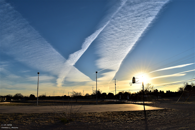
Sunrise Contrails Over Carlsbad, NM.
Winter Storm #1 Today Into Monday.
As of 5 AM MST this Sunday morning the Personal Weather Station (PWS) 3 Cross located northeast of Elk, and north of Dunken, along the foothills of the Sacramento mountains had already clocked a peak gust to 71 mph. Strong southwesterly winds are already in progress at sunrise this Sunday morning. A few of the stronger gusts being reported included:
3 Cross PWS located northeast of Elk and north of Dunken 71 mph.
The Smokey Bear Raws 1 mile northwest of Ruidoso 66 mph.
The Bowl Raws located just north of Guadalupe Peak 63 mph.
Sierra Blanca Regional Airport 59 mph.
Pinery Raws In The Guadalupe Mtn's Natl Park 55 mph.
The Dunken Raws located west of Hope 55 mph.
Guadalupe Pass 44 mph.
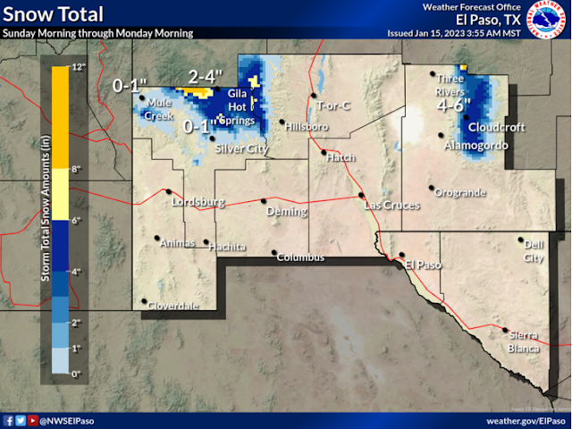
Southern Sacramento Mountains: From Noon MST today through 6 AM MST Monday. Up to 4" to 7" of new snowfall above 7,500'. This includes the Sunspot, Cloudcroft, Wimsatt, Silver Lake, Apache Summit areas. The Mayhill/Sacramento/Weed/Timberon areas could get 1" to 3" of new snowfall by Monday.
New snowfall totals of around 3" to 5" are forecast for the Ruidoso area. And up to 10" to 16" are forecast for Ski Apache.
Southwest to westerly winds gusting up into the 55-65 mph range today will create areas of blowing and drifting snow. Travel upon local roads and highways across the Sacramento Mountains above 7,000' may be difficult in some areas.
High Wind Warnings/Wind Advisories In Effect Today:
Guadalupe Mountains Of Eddy County and Culberson County in West Texas: West winds sustained at 40-60 mph with gusts near 85 mph.
Southern Sacramento Mountains and parts of southern New Mexico: Southwest winds becoming sustained at around 35-45 mph with gusts near 60 mph.
Southern Sacramento Mountains and parts of southern New Mexico: Southwest winds becoming sustained at around 35-45 mph with gusts near 60 mph.
Wind Advisory for Chaves County: Southwest to west winds sustained at around 25-35 mph with gusts near 55 mph.
Wind Advisory for Eddy/Lea Counties: Southwest to west winds becoming sustained at around 30-40 mph gusting to around 55 mph.
Wind Advisory for Eddy/Lea Counties: Southwest to west winds becoming sustained at around 30-40 mph gusting to around 55 mph.
Local areas of blowing dust will occur across the lower elevations of the Southeastern Plains and southern New Mexico today. Sudden drops in the visibility down to near zero with little or no advanced warning will occur in and near the following locations:
Freshly plowed, open, or exposed farmland, fields, and lots. And highway construction sites. Watch out for those tumbling tumbleweed attacks too.
Our second winter storm will impact the local area Tuesday into Wednesday morning. More snow for the mountains and strong winds and blowing dust across the plains are in the cards. The third winter storm to impact the area will come late next week into the weekend.
NWS NDFD Snowfall Forecast.
Valid Today Through 5 AM MST Wednesday.
Valid Today Through 1 AM MST Monday Morning.


Comments
Post a Comment
Your comments, questions, and feedback on this post/web page are welcome.