


Peak Wind Reports - Wednesday January 11, 2023.
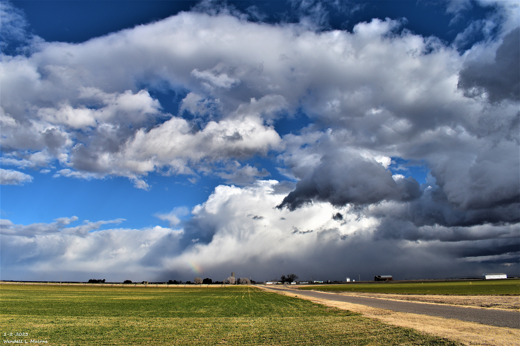
Small Rainbow - Cottonwood, NM.
Blog Updated At 1:13 PM MST Thursday, January 12, 2023.
(Wednesday, January 11, 2023.)


(Wednesday, January 11, 2023.)


Peak Gust Wednesday Morning 67 MPH.

A peak wind gust of 73 mph was recorded at the Pine Springs Mesonet Station located in the Guadalupe Mountains National Park. The Queen Raws reported a peak gust to 64 mph and the Carlsbad Airport 53 mph.
Public Information Statement
National Weather Service Albuquerque NM
315 PM MST Wed Jan 11 2023

...HIGHEST WIND REPORTS...

Location                     Speed     Time/Date

...New Mexico...

...Bernalillo County...
I-40 Sedillo Hill (NMDOT)    44 MPH    1035 AM 01/11
Albuquerque Intl Sunport     41 MPH    1145 AM 01/11

...Chaves County...
Dunken 2 NE (Dunken)         59 MPH    1136 AM 01/11
Bitter Lake WL Refuge 14 NNE 46 MPH    1137 AM 01/11
Hagerman                     45 MPH    1200 PM 01/11
Roswell Air Center           41 MPH    1118 AM 01/11
Dexter                       40 MPH    1210 PM 01/11

...Cibola County...
Grants-Milan Airport         40 MPH    0935 AM 01/11

...Colfax County...
Raton Crews Airport          56 MPH    1133 AM 01/11
Cimarron                     41 MPH    0935 AM 01/11
Angel Fire Airport           40 MPH    0655 AM 01/11

...Curry County...
Cannon AFB                   60 MPH    0113 PM 01/11
St. Vrain                    56 MPH    1215 PM 01/11
Cannon AFB                   54 MPH    1137 AM 01/11
Clovis                       52 MPH    1238 PM 01/11
Clovis Muni Airport          48 MPH    1132 AM 01/11
Clovis ASC (NMCC)            44 MPH    1220 PM 01/11

...De Baca County...
East Fort Sumner             62 MPH    1220 PM 01/11
Fort Sumner 1 E              59 MPH    1220 PM 01/11
South Ft Sumner              49 MPH    1045 AM 01/11

...Guadalupe County...
Se Vaughn                    67 MPH    1150 AM 01/11
Puerto De Luna 3.3e          59 MPH    1020 AM 01/11
Thompson Cattle              58 MPH    1225 PM 01/11
Newkirk                      54 MPH    1230 PM 01/11
Cuervo 3.5 NE (UPR)          52 MPH    1222 PM 01/11
Santa Rosa Airport           49 MPH    0915 AM 01/11
Pecriv                       45 MPH    0940 AM 01/11
Santa Rosa 2 SW (UPR)        45 MPH    1036 AM 01/11
Santa Rosa Airport           40 MPH    0915 AM 01/11
Pastura 2 NE (UPR)           40 MPH    0953 AM 01/11
Santa Rosa 7 E (UPR)         40 MPH    1046 AM 01/11

...Lincoln County...
Bonito Lake 5 SW             57 MPH    0139 PM 01/11
Sierra Blanca Rgnl Arpt      46 MPH    0855 AM 01/11
Ruidoso 1 NNW (Smokey Bear)  46 MPH    1200 PM 01/11

...Los Alamos County...
Los Alamos Airport           48 MPH    0917 AM 01/11
Los Alamos 5 SSW (LANL)      41 MPH    1215 PM 01/11

...Quay County...
Tucumcari Muni Airport       61 MPH    1037 AM 01/11
Tucumcari                    58 MPH    1225 PM 01/11
Logan                        54 MPH    0935 AM 01/11
Endee 2 SW                   54 MPH    1240 PM 01/11
Tucumcari 9 NE  (UPR)        49 MPH    1137 AM 01/11
Logan 12 NE (UPR)            45 MPH    0953 AM 01/11
Endee 2 SW                   43 MPH    1020 AM 01/11
Tucumcari 4 W (UPR)          43 MPH    1112 AM 01/11
Montoya (UPR)                43 MPH    1137 AM 01/11
Logan 2.2 SE (UPR)           43 MPH    1147 AM 01/11

...Rio Arriba County...
Alcalde ASC (NMCC)           43 MPH    0945 AM 01/11

...Roosevelt County...
Tolar 13 SE                  59 MPH    0118 PM 01/11
Tolar 13 SE (Melrose Range)  48 MPH    1214 PM 01/11
Roosevelt Swcd               47 MPH    1210 PM 01/11
Portales 1 SW                40 MPH    1130 AM 01/11

...San Miguel County...
Tecolotito 6 N               68 MPH    1114 AM 01/11
Las Vegas Muni Airport       56 MPH    0533 AM 01/11
Lower Colonias 5 E (Pecos)   44 MPH    0714 AM 01/11
Apache Springs 1 NE          41 MPH    0644 AM 01/11

...Sandoval County...
Valles Caldera HQ (DRI)      45 MPH    0630 AM 01/11
San Antonio (DRI)            42 MPH    0620 AM 01/11
Cuba 9 SW (Cuba)             40 MPH    0341 AM 01/11

...Santa Fe County...
Santa Fe Muni Airport        47 MPH    1003 AM 01/11

...Socorro County...
Contreras 1 ESE (Sevilleta)  42 MPH    1211 PM 01/11

...Taos County...
Red River 8 S                66 MPH    0600 AM 01/11
Taos Muni Airport            53 MPH    0940 AM 01/11
Arroyo Seco 3 SW             51 MPH    0930 AM 01/11
Taos Swcd                    48 MPH    1050 AM 01/11
Lama 4 NW (Wild Rivers)      46 MPH    0949 AM 01/11
Taos Pueblo Raws             45 MPH    1013 AM 01/11
Talpa 1 NE                   43 MPH    1015 AM 01/11
Taos                         42 MPH    0945 AM 01/11
Taos Muni Airport            41 MPH    0956 AM 01/11

...Torrance County...
Clines Corners 1 SSE         63 MPH    0908 AM 01/11
Edgewood Swcd                47 MPH    1205 PM 01/11
Estancia 2 WSW               46 MPH    0924 AM 01/11
Clines Corners 1 SSE         43 MPH    0853 AM 01/11
Moriarty Muni Airport        41 MPH    0835 AM 01/11
Estancia 7 SSW               41 MPH    0915 AM 01/11

...Union County...
Clayton LRC                  61 MPH    1105 AM 01/11
Sw Clayton                   60 MPH    1035 AM 01/11
Clayton Muni Airpark         60 MPH    1048 AM 01/11
Sedan                        55 MPH    1200 PM 01/11
Amistad                      52 MPH    1220 PM 01/11
South Clayton                46 MPH    1145 AM 01/11
Sedan 5 N                    40 MPH    1147 AM 01/11

Observations are collected from a variety of sources with varying
equipment and exposures. We thank all volunteer weather observers
for their dedication. Not all data listed are considered official.
NWS Midland Peak Wind Gusts.PRELIMINARY LOCAL STORM REPORT
NATIONAL WEATHER SERVICE MIDLAND/ODESSA TX
1005 PM CST WED JAN 11 2023
..TIME... ...EVENT... ...CITY LOCATION... ...LAT.LON...
..DATE... ....MAG.... ..COUNTY LOCATION..ST.. ...SOURCE....
..REMARKS..
0117 PM NON-TSTM WND GST 3 NW WINK 31.78N 103.20W
01/11/2023 M51 MPH WINKLER TX ASOS
ASOS STATION KINK WINK.
1258 PM NON-TSTM WND GST 7 WSW MCDONALD OBSERVAT 30.65N 104.14W
01/11/2023 M63 MPH JEFF DAVIS TX MESONET
MESONET STATION WDPT2 WOLF DEN DMP.
0124 PM NON-TSTM WND GST 2 NNE SEMINOLE 32.74N 102.64W
01/11/2023 M56 MPH GAINES TX MESONET
MESONET STATION 25 SEMINOLE 2N.
0155 PM NON-TSTM WND GST 2 SSE LAMESA 32.71N 101.94W
01/11/2023 M50 MPH DAWSON TX MESONET
MESONET STATION 18 LAMESA 2SE.
0215 PM NON-TSTM WND GST 3 ENE LAMESA 32.75N 101.92W
01/11/2023 M51 MPH DAWSON TX AWOS
AWOS STATION KLUV LAMESA.
1038 AM NON-TSTM WND GST 3 NNW PINE SPRINGS 31.93N 104.83W
01/11/2023 M59 MPH CULBERSON TX MESONET
MESONET STATION GDBT2 THE BOWL.
0321 PM NON-TSTM WND GST PINE SPRINGS 31.89N 104.81W
01/11/2023 M73 MPH CULBERSON TX MESONET
MESONET STATION 60 PINE SPRINGS GMNP.
0215 PM NON-TSTM WND GST 3 WNW FLUVANNA 32.90N 101.20W
01/11/2023 M53 MPH BORDEN TX MESONET
MESONET STATION 31 FLUVANNA 3W.
0146 PM NON-TSTM WND GST 2 SW TATUM 33.24N 103.34W
01/11/2023 M51 MPH LEA NM MESONET
MESONET STATION CW0386 TATUM.
0245 PM NON-TSTM WND GST 12 ESE HALFWAY 32.47N 103.55W
01/11/2023 M50 MPH LEA NM MESONET
MESONET STATION FW9687 EUNICE.
0213 PM NON-TSTM WND GST 3 ENE QUEEN 32.20N 104.69W
01/11/2023 M61 MPH EDDY NM MESONET
MESONET STATION QENN5 QUEEN.
0256 PM NON-TSTM WND GST 5 WSW OTIS 32.33N 104.25W
01/11/2023 M56 MPH EDDY NM ASOS
ASOS STATION KCNM CARLSBAD.


Comments
Post a Comment
Your comments, questions, and feedback on this post/web page are welcome.