Current Date & Time

NWS Albuquerque 2025 -2026 New Mexico Winter Outlook.

Oct 22, 2025
Sunrise Between Hobbs & Carlsbad.

I hate to be the bearer of bad news, but this upcoming winter is not looking good at all for New Mexico as far as snowfall is concerned. An early indicator of this was back this summer, when the Pacific Decadal Oscillation cratered to an all-time low. 

The Pacific Decadal Oscillation (PDO) is a long-term climate pattern that affects the temperature of the Pacific Ocean and the weather patterns around it. The PDO is a naturally occurring phenomenon that shifts between warm and cool phases, with each phase lasting around 20-30 years (World Climate Service). A brief summary of the PDO is also available from the Physical Sciences Laboratory. The chart on the upper right shows a time series of the PDO since the late 1800s. The July 2025 PDO value of -4.15 was the lowest on record.

Overall, it looks like we are in for another warmer and drier-than-normal winter. This does not bode well for the state's Ski Resorts, annual snowpack, and spring runoff. Not to mention that this will only add to an already bad fire weather situation due to the ongoing and worsening drought. 

Given the upper air pattern that is beginning to set up across the northern hemisphere, I think that we will see several shots of arctic air into the eastern half of the state this winter. Some of these arctic invasions may be on the brutal side, temperature-wise. 

Overall, this winter's snowfall across the state and nearby areas is currently forecast to be below normal, but that does not mean that we won't see some snowstorms impact the state and region this winter. History and climatology teach that there have been significant snowstorms in New Mexico during La Niña winters. 

Another concern that I have is that the valleys and lowlands of eastern, southeastern, and southern New Mexico will once again be subjected to multiple duststorms this winter and next spring. Much like we've seen over the past couple of winters and springs. 

Having been a lifelong resident of New Mexico for the past 67 years, I can tell you that our winter weather does not always play nice or as forecast. So don't be surprised if there are surprises this winter. 

Please open up the link below to read the full article from the Albuquerque National Weather Service Office (NWS). 


There Are None So Blind As Those Who "Will - Not" To See...107.

Comments

My Blog Archive List (July 2010 - August 2025).

Show more

My Current Weather Conditions

MY CoCoRaHS Precipitation Data

NWS Albuquerque 2026 Winter Outlook (Updated Nov 3rd).

NWS Midland Web Page

NWS Midland Web Page
Click On The Map To Open It Up

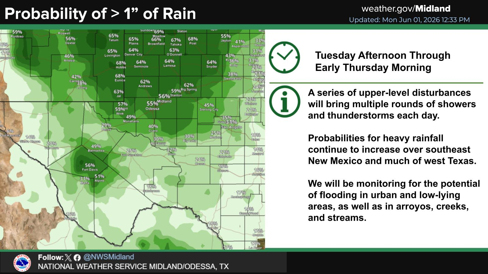
SE New Mexico & West Texas Precipitation Forecasts

Eddy County

Guadalupe Mtns Eddy & Culberson County

Lea County

NWS Midland Hazardous Weather Outlook

NWS Midland Hazardous Weather Outlook
Click On The Image To See The Rest Of The Outlooks

NWS Midland Forecast High Temperatures Today

NWS Midland Forecast Low Temperatures Tonight

NWS Midland Peak Wind Gust Forecast

NWS Midland Graphic Forecast

NWS Midland Graphic Forecast
Below normal highs today with temperatures in the upper 40s to mid 50s. Clouds remain across most areas today with light drizzle possible.

NWS Midland Forecast Graphic

NWS Midland Forecast Graphic
High temperatures will continue to trend downward through early next week, with below average high temperatures for the area Monday and Tuesday despite lows generally remaining above frost advisory criteria. A gradual warming trend sets in after Wednesday, but rain chances will only return to the area late week into next weekend.

NWS Albuquerque Web Page

NWS Albuquerque Web Page
Click On The Map To Open It Up

NWS Albuquerque New Mexico Precipitation Forecasts

New Mexico

Chaves County Plains & Mtn's

Lincoln County

NWS Albuquerque Hazardous Weather Outlook

NWS Albuquerque Hazardous Weather Outlook

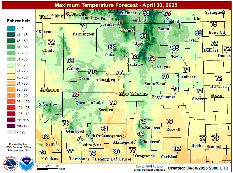
NWS Albuquerque Forecast High Temperatures Today

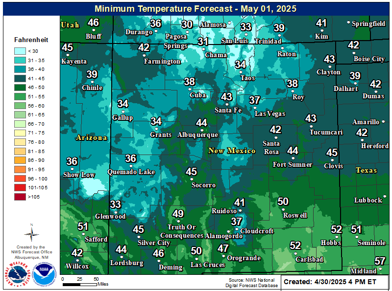
NWS Albuquerque Forecast Low Temperatures Tonight

NWS Albuquerque Wind Chill Forecast

NWS Albuquerque Peak Wind Gust Forecast

NWS Albuquerque Graphic Forecast

NWS Albuquerque Graphic Forecast
A Dense Fog Advisory continues until 9AM this morning for much of central and northeast NM.

NWS Albuquerque Graphic Forecast

NWS Albuquerque Graphic Forecast
Increasing south to southwest winds are expected across some parts of northern and central NM Tuesday ahead of an approaching storm system. Some difficult crosswinds on east to west oriented roadways. Unsecured objects may blow around.

NWS Albuquerque Graphic Forecast

NWS Albuquerque Graphic Forecast
Calmer weather continues today before the next storm brings rain and mountain snow chances across western and central New Mexico Tuesday evening through Wednesday morning. Another storm is poised to bring rain and mountain snow chances to northwest and north central New Mexico Friday.

NWS El Paso Web Page

Southern New Mexico & Far West Texas Precipitation Forecasts

Texas

Otero County

NWS El Paso Hazardous Weather Outlook

NWS El Paso Hazardous Weather Outlook
Click On The Image To See The Rest Of The Outlooks

NWS El Paso Hazardous Weather Outlook

NWS El Paso Hazardous Weather Outlook
Click On The Image To See The Rest Of The Outlooks

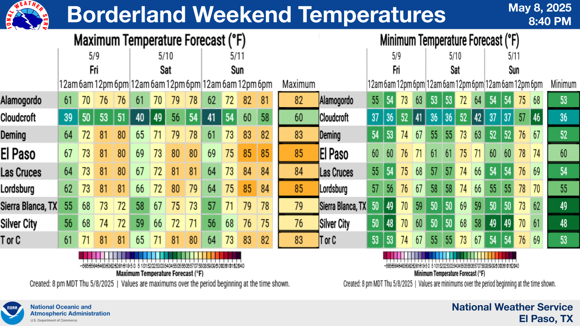
NWS El Paso Forecast High Temperatures Today

NWS El Paso Forecast Low Temperatures Tonight

NWS El Paso Wind Chill Forecast

NWS El Paso Peak Wind Gust Forecast

NWS El Paso Graphic Forecast

NWS El Paso Graphic Forecast
A Dense Fog advisory is in effect for much of the Sacramento Mountains for tonight through 9 AM on Monday. Visibilities will drop below 1/4 of mile so motorists should exercise caution if out tonight into Monday morning.

NWS El Paso Graphic Forecast

NWS El Paso Graphic Forecast
A cold front will move across the region tonight and that will give us high temperatures on Monday a little below average. Our winds will be light. Most of us will see plenty of sun, but some lower clouds will sneak into Otero and Hudspeth Counties behind the cold front.

NWS Lubbock Web Page

NWS Lubbock Web Page
Click On The Map To Open It Up

NWS Lubbock South Plains Precipitation Forecasts

NWS Lubbock Hi Temperature Forecast Today

NWS Lubbock Low Temperature Forecast Tomight

NWS Lubbock Graphic Forecast

NWS Lubbock Graphic Forecast
Fog is likely across the region through late morning. While the fog will lift, clouds will remain through the rest of the day and through the night. This will keep highs near 50 and lows in the upper 30s to mid 40s.

NWS Lubbock Graphic Forecast

NWS Lubbock Graphic Forecast
After starting off foggy and cool, the week will eventually warm into the 60s. Shower and thunderstorm chances return Thursday.

My Rainfall Totals - 2.1 NNW Downtown Carlsbad

My Rainfall Totals - 2.1 NNW Downtown Carlsbad

My Seasonal Snowfall Totals - 2.1 NNW Downtown Carlsbad

My Seasonal Snowfall Totals - 2.1 NNW Downtown Carlsbad

Disclaimer

This blog and its contents are for informational purposes only! Always have multiple sources of information available to rely upon during severe weather. Do not rely solely on the Internet. Be weather-aware, plan ahead, have a backup plan, and be ready to act before severe weather strikes your location.