Why Are My Weather Posts Missing From Facebook.

Hello everyone. I just wanted to let you know that my Facebook page was shut down without any warning by Facebook this past Saturday, June 8th. All I was told was that I had violated their community standards. I don't know what triggered that; they didn't tell me. I was told this may be permanent or for six months.
My guess is that it may be because I posted several comments and articles from my Substack page about the riots in LA, and that must have triggered/angered someone, and they complained, thus Facebook shut me down. I don't know this as fact, though. I have appealed this decision, and I'm still waiting for their reply. I have read on X that this has happened to other Facebook users posting about the LA riots as well.
I always share my weather blog posts (that I post here) on my Facebook page and my X page. This included over twelve different New Mexico and West Texas Facebook Community sites. So there are thousands of you out there (based on my views and shares of those posts) who will no longer see those posts. My Facebook page may or may not be restored.
This is another good reason (as the National Weather Service often reminds us) to have multiple ways of receiving severe weather alerts when severe weather threatens your location. My weather web page is one of those ways, and I really appreciate all of you who have and still do use it. Thank you so much!!!
If my Facebook page is restored, I will continue to share my weather blog posts and some of the NWS Watches and Warnings...as I have been doing for years now.

Coolest Morning Of The Season Yet.


I took this yesterday in Carlsbad just before sunset.

(Sunday Sept 16, 2012).


Dense fog blanketed parts of southeastern New Mexico as the sun rose this morning. Visibilities in some locations were down to 1/4 of a mile or less. The fog had burned off by 10:30 AM. 

Early morning low temperatures this morning were some of the coolest readings of this season so far. After needing a jacket in some places this morning, it will be shirt sleeve weather this afternoon and tomorrow. Our forecast high temperatures are expected to be in the upper 80's today, and the low-mid 90's on Monday under sunny skies.


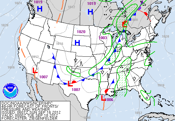
Valid At Noontime Tuesday September 18, 2012.

Is it summer, or is it early fall? Its that time of the year when we can see some pretty wild temperature swings. This will happen again when another cold front enters the local area by around sunset on Monday.

 After seeing our high temps reach 90-95 Monday afternoon, cooler air will overspread the area Monday night behind the cold front. Our high temps on Tuesday are forecast to be in the upper 70's to near 80.

Summer isn't ready to give up just yet as our afternoon highs will rebound right back up into the 90's on Wednesday and into the weekend. 

The Truth Is Stranger Than Fiction!

 My Web Page Is Best Viewed With Google Chrome.

Comments

NWS Albuquerque Burn Scar Matrix

Current National Weather Service Watches/Warnings In Effect.

New Mexico

Chaves County Plains & Mtn's

Eddy County

Culberson County

Lea County

Lincoln County

Otero County

Current US Temps

Current US Wind Chill/Heat Index Temperatures

WPC 7-Day Precipitation Forecast

Roswell Live EarthCam

Ruidoso Live Webcam

Cloudcroft Live Webcam

NWS Midland 3-Day Precipitation Forecast

NWS Midland 3-Precipitation Chances

New Mexico 3-Day Precipitation Forecast

New Mexico Precipitation Chances

NWS El Paso 3-Day Precipitation Forecast

NWS El Paso Precipitation Chances

US 24-Hour Precipitation Forecast

US 3-Day Precipitation Forecast