My Blog Archive List (July 2010 - August 2025).

Show more

Viewing My Web Page

If you are viewing my web page on your cell phone, then be sure and click on the three white bars located in the top left-hand corner of the page (only visible on your phone). This is the menu bar, and it opens up additional links and graphics. Such as forecast maps, severe weather outlooks, current conditions, radar and satellite links, and more.

Arctic Air Grips NM - Winter Storm Approaching From California.


Blog Updated @ 4:35 PM MST Today.


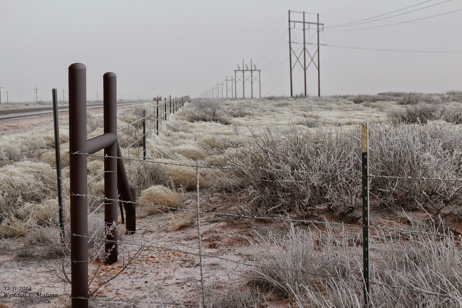
Glazing from light freezing drizzle and light freezing fog at the Red Hills Gas Plant (Agave Energy Co) this morning. Located 21 miles WNW of Jal, NM, in Lea Co, at MM32 on St Hwy 128.
Snow packed roads in Carlsbad, NM this morning. A layer of black ice lies underneath the snow on local roads and highways in and around Carlsbad. Extremely slick conditions exists. We now have 11/2" of snow on the ground at our home here in NW Carlsbad.

Potent Closed 500 MB Low Headed To NM.


Arctic air grips most of New Mexico this morning. Low temperatures across the local area have ranged from the single digits to the mid teens. Wind chill values this morning across the area range from near zero to near -20°F. Our highs today in SE NM will generally be in the teens and 20's. 

A powerful upper level closed low located over southern California this morning is forecast to move slowly east and southeast towards southern New Mexico by Saturday morning. The exact track and speed of this storm will determine just where the heaviest snows will fall...which as of this morning still are uncertain. 

Mid-level moisture from the Baja Region is beginning to get ingested into the southwesterly flow aloft ahead of the storm which will help to moisten up the mid levels of the atmosphere and further the chances for more widespread and heavier snows over the area.

Winter Storm Impacts Upon The Desert SW.

A host of Watches and Warnings are in effect for the area. Please click on this
National Weather Service Map Link to get the very latest information 
and updates for your areas of interests. 


The Truth Is Stranger Than Fiction! 

 My Web Page Is Best Viewed With Google Chrome.

Comments

Current US Hazardous Weather Watch/Warning Map

New Mexico

Texas

Arizona

Colorado

Eddy County

Guadalupe Mtns Eddy & Culberson County

Chaves County Plains & Mtn's

Lea County

Lincoln County

Otero County

🔴 Live 24/7 National Weather Radar & Alerts, Weather Intensity Score & YallBot!

Weather With Travis

NWS Albuquerque 2025-2026 Winter Outlook

Weather With Travis

2025 -2026 Winter Outlook

Ruidoso Live Webcam

Ski Apache Webcam Live Link

Ski Apache Webcam Live Link
Click On The Image To Open It Up

Cloudcroft Live Webcam

Roswell Live EarthCam

Average Daily High/Low Temps & Precipitation

Average Daily High/Low Temps & Precipitation

My Precipitation Totals - 2.1 NNW Downtown Carlsbad

My Precipitation Totals - 2.1 NNW Downtown Carlsbad

My Top 10 Most Popular Posts

Artesia, NM Mothership Supercell Thunderstorm. 9-17-2016.

Monster Of A Snowstorm Coming This Christmas Weekend?

Powerful Winter Storm Is Hammering New Mexico! Worst Is Yet To Come.

25th Anniversary Of The Carlsbad, NM (May 31, 1991) Tornado Coming Up.

Major Winter Storm May Paralyze/Bury Parts Of NM & Nearby Areas Tonight Into Wednesday!

2011 Skywarn Spotter Training Classes & My Thoughts.

Tonight's GFS Is As Drunk As This Mornings ECMWF. Historic Snowstorm Next Weekend?

Are We Fixing To Go From Drought To Flood In SE NM?

Major Winter Storm To Hammer New Mexico & West Texas Thanksgiving Week!

Cloudcroft & Ruidoso, NM Seasonal Snowfall Totals.

My Favorite Blog List.

Substack

Disclaimer

This blog and its contents are for informational purposes only! Always have multiple sources of information available to rely upon during severe weather. Do not rely solely on the Internet. Be weather-aware, plan ahead, have a backup plan, and be ready to act before severe weather strikes your location.