More T-Storms & Heavy Rains.
7-31-2016
North Of Silver Lake In The Sacramento Mountains.
GFS Storm Total Rainfall Forecast.
Valid @ 6 AM MDT Tuesday, August 16, 2016
WPC 7-Day Storm Total Rainfall Forecast.
Valid @ 6 AM MDT Wednesday, August 17, 2016
NAM/WRF Storm Total Rainfall Forecast.
Valid @ Noon AM MDT Saturday, August 13, 2016.
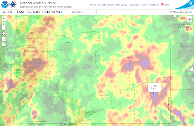
As they often do when dealing with a deep subtropical moisture feed and approaching cold front the forecast models have started their usual flip flopping on where the heaviest rains will fall and how much. Locally heavy rains have fallen over the area the past couple of days and we are still on track for more heavy rain. Note that the 06Z run of the NAM/WRF model depicted above still forecasts 5"-6" over parts of Lea County by noontime Saturday.
Once again scattered thunderstorms producing locally heavy rains are in the cards today. More so on Friday into Saturday as a cold front sags southward into the local area. Again thunderstorms will produce heavy rainfall along with the possibility of flash flooding. I still expect to see local storm total rainfall amounts in the 2" - 6" range, maybe higher in a few spots.
(Past 24 & 72 Hours).
Reported Rainfall Totals Past 24-Hours.
(Along With Radar Estimated Totals).
Radar Estimated Rainfall Totals.
(Past 72 Hours).
The Truth Is Stranger Than Fiction!


Comments
Post a Comment
Your comments, questions, and feedback on this post/web page are welcome.