Current Date & Time

Fall Freeze Data For New Mexico

Christmas Climatology For SE NM & Nearby Areas.


Christmas Eve Morning 2011.

On Christmas Eve morning in 2011, we had 11" of snow on the ground and 9" on the ground Christmas morning at our home in Carlsbad, New Mexico. The Carlsbad Climate Co-Op Station reported 12" on the ground Christmas morning. For most of the local area, this marked the greatest snowfall and snow depth reported on Christmas Eve and Christmas Day (1893-2018).

I've updated my historical snowfall/snow depth spreadsheet for Christmas Eve and Christmas Day and it now includes the local CoCoRaHS reports that are available. I've included the most recent updated data for our local climatology during the Christmas holidays. Climatology records go back to 1893 for Roswell, 1900 for Carlsbad, 1905 for Artesia, 1941 for Ruidoso, 1901 for Cloudcroft, and 1913 for Hobbs. Records include data through 2018.

Southeastern New Mexico Christmas Eve & Christmas Day Climatology.

Christmas Eve.
Chaves County.


Christmas Day.
Chaves County.


Christmas Eve.
Eddy County.


Christmas Day.
Eddy County.


Christmas Eve.
Lea County.


Christmas Day.
Lea County.


Christmas Eve.
Northern Sacramento Mountains.


Christmas Day.
Northern Sacramento Mountains.


Christmas Eve.
Southern Sacramento Mountains.


Christmas Day.
Southern Sacramento Mountains.


Christmas Eve.
Southern New Mexico And Nearby Areas.


Christmas Day.
Southern New Mexico And Nearby Areas.


Our historical climatology data is courtesy of:

ACIS

The Truth Is Stranger Than Fiction - And Sometimes It Hurts!

Comments

My Blog Archive List (July 2010 - August 2025).

Show more

My Current Weather Conditions

MY CoCoRaHS Precipitation Data

NWS Albuquerque 2026 Winter Outlook (Updated Nov 3rd).

NWS Midland Web Page

NWS Midland Web Page
Click On The Map To Open It Up

SE New Mexico & West Texas Precipitation Forecasts

Eddy County

Guadalupe Mtns Eddy & Culberson County

Lea County

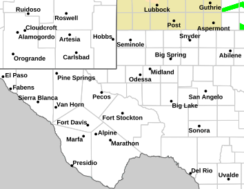
NWS Midland Hazardous Weather Outlook

NWS Midland Hazardous Weather Outlook
Click On The Image To See The Rest Of The Outlooks

NWS Midland Hazardous Weather Outlook

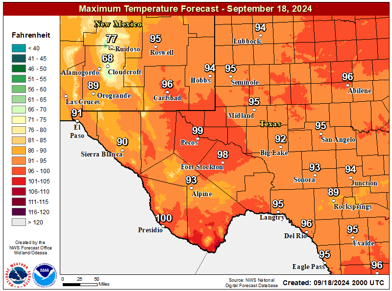
NWS Midland Forecast High Temperatures Today

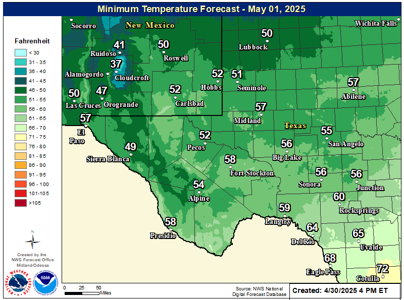
NWS Midland Forecast Low Temperatures Tonight

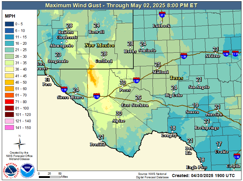
NWS Midland Peak Wind Gust Forecast

NWS Midland Forecast Graphic

NWS Midland Forecast Graphic
An upper-level disturbance brings rain chances back in the forecast Friday night through Saturday. Rainfall amounts look to remain light keeping the flash flood threat very low. Localized flooding may occur across the Davis Mountains and Big Bend due to runoff with any heavier pockets of rainfall.

NWS Albuquerque Web Page

NWS Albuquerque Web Page
Click On The Map To Open It Up

NWS Albuquerque New Mexico Precipitation Forecasts

New Mexico

Chaves County Plains & Mtn's

Lincoln County

NWS Albuquerque Hazardous Weather Outlook

NWS Albuquerque Hazardous Weather Outlook

NWS Albuquerque Forecast High Temperatures Today

NWS Albuquerque Forecast Low Temperatures Tonight

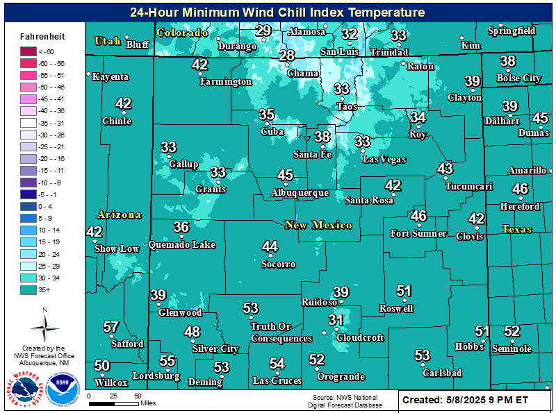
NWS Albuquerque Wind Chill Forecast

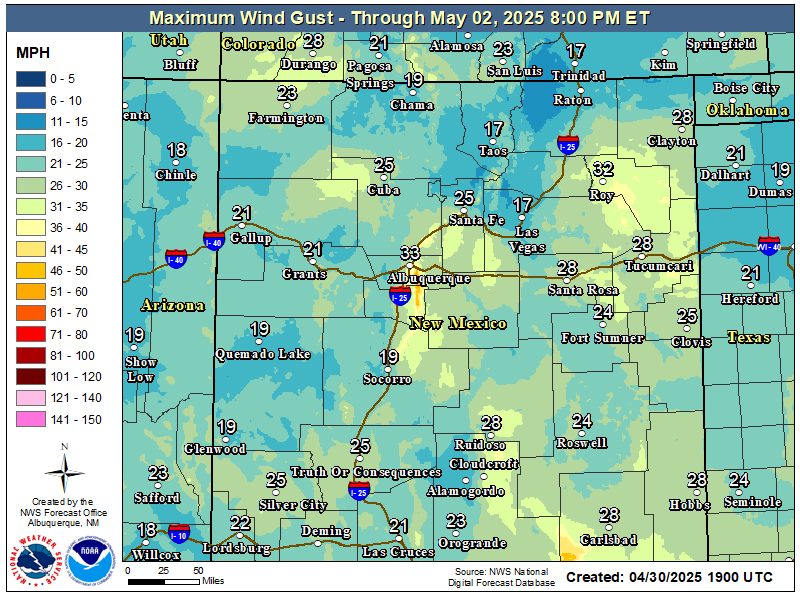
NWS Albuquerque Peak Wind Gust Forecast

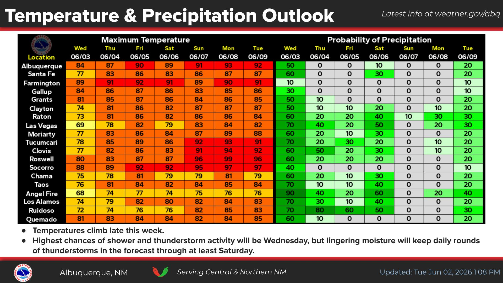
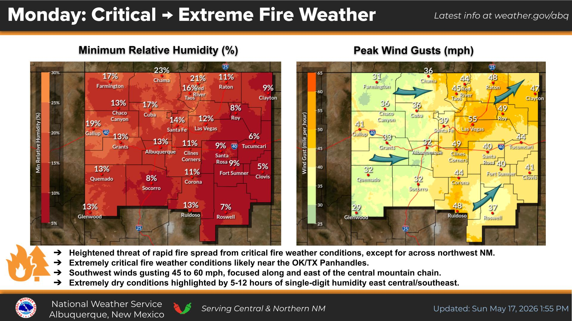
NWS Albuquerque Graphic Forecast

NWS Albuquerque Graphic Forecast
Pleasant Fall weather persists today with light winds and mostly sunny skies!

NWS Albuquerque Graphic Forecast

NWS Albuquerque Graphic Forecast
High temperatures remain rather pleasant with mostly tranquil weather today before slightly cooler and wetter weather arrives late Friday through Saturday. Another round of wetter weather returns by Tuesday next week.

NWS Albuquerque Graphic Forecast

NWS Albuquerque Graphic Forecast
Mostly light rain crosses NM late Friday thru Saturday night mainly south of I-40. Second storm brings valley rain and mountain snow to northern and eastern NM Saturday morning thru Saturday night. Low risk of localized flooding across northwest NM where wet ground conditions persist.

NWS Albuquerque Forecast Grpahics

NWS Albuquerque Forecast Grpahics
Slick winter travel impacts will favor the high elevations of northern New Mexico, mainly above 9,000 feet. The second in a tandem of storm systems passes over northern and eastern New Mexico bringing valley rain and high mountain snow, with some thunderstorms mixed in.

NWS El Paso Web Page

Southern New Mexico & Far West Texas Precipitation Forecasts

Texas

Otero County

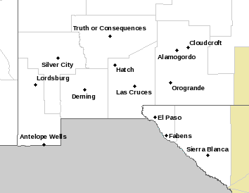
NWS El Paso Hazardous Weather Outlook

NWS El Paso Hazardous Weather Outlook
Click On The Image To See The Rest Of The Outlooks

NWS El Paso Hazardous Weather Outlook

NWS El Paso Hazardous Weather Outlook
Click On The Image To See The Rest Of The Outlooks

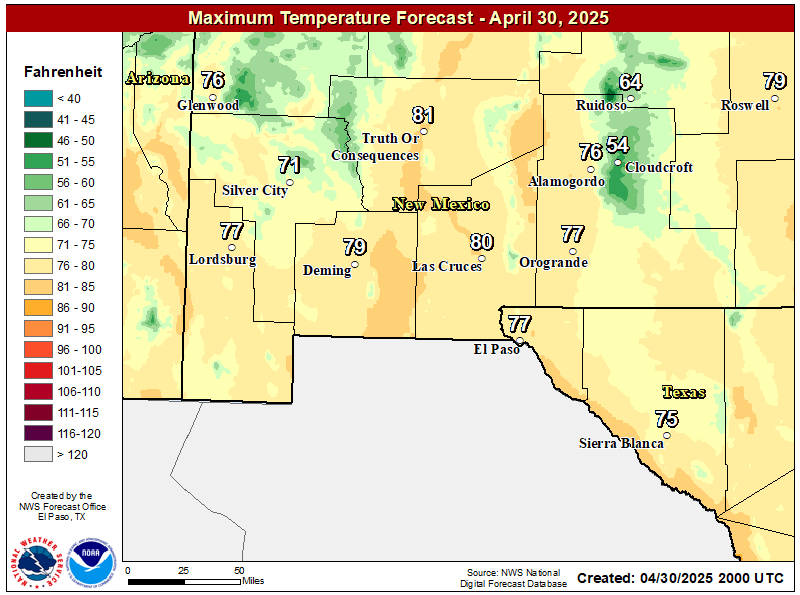
NWS El Paso Forecast High Temperatures Today

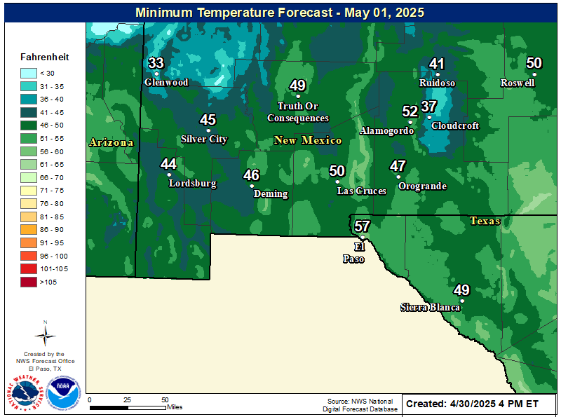
NWS El Paso Forecast Low Temperatures Tonight

NWS El Paso Wind Chill Forecast

NWS El Paso Graphic Forecast

NWS El Paso Graphic Forecast

NWS El Paso Graphic Forecast

NWS Lubbock Web Page

NWS Lubbock Web Page
Click On The Map To Open It Up

NWS Lubbock Hazardous Weather Outlook

NWS Lubbock Hazardous Weather Outlook
Click On The Image To See The Rest Of The Outlooks

NWS Lubbock Hazardous Weather Outlook

NWS Lubbock Hazardous Weather Outlook
Click On The Image To See The Rest Of The Outlooks

NWS Lubbock South Plains Precipitation Forecasts

NWS Lubbock Hi Temperature Forecast Today

NWS Lubbock Low Temperature Forecast Tomight

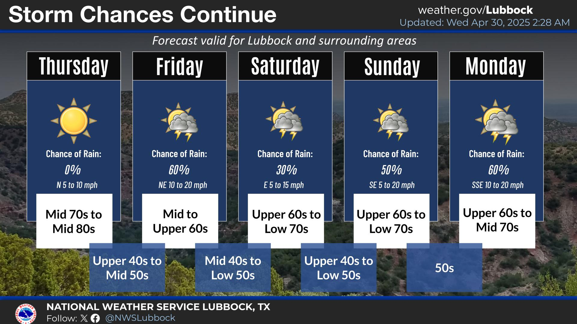
NWS Lubbock Graphic Forecast

NWS Lubbock Graphic Forecast
Mild and sunny conditions are expected across the region today. Winds will generally be out of the west at 5-10 mph.

NWS Lubbock Graphic Forecast

NWS Lubbock Graphic Forecast
A chance for showers returns to the region during the day on Saturday. The best chance for showers, and a few storms, is Saturday evening into Saturday night. Showers and storms may linger into Sunday off the Caprock. Total rainfall amounts are unlikely to exceed an inch on the Caprock, while off the Caprock there is a chance (20-40%) for over one inch of rain.

NWS Lubbock Graphic Forecast

NWS Lubbock Graphic Forecast
Precipitation chances return Friday night through Sunday, with the best chances being Saturday night. Severe storms are not expected, but rainfall amounts over an inch are possible (20-40% chance) off the Caprock. Cooler conditions are expected at the start of next week, when highs may only be in the low 50s.

My Rainfall Totals - 2.1 NNW Downtown Carlsbad

My Rainfall Totals - 2.1 NNW Downtown Carlsbad

My Seasonal Snowfall Totals - 2.1 NNW Downtown Carlsbad

My Seasonal Snowfall Totals - 2.1 NNW Downtown Carlsbad

Disclaimer

This blog and its contents are for informational purposes only! Always have multiple sources of information available to rely upon during severe weather. Do not rely solely on the Internet. Be weather-aware, plan ahead, have a backup plan, and be ready to act before severe weather strikes your location.